Pico Austria Day Hike: Summit A 5,320 m Peak In Bolivia
Pico Austria is a stunning high-altitude day trek in Bolivia, standing at 5,320 m (17,454 ft) – about the same elevation as the Everest Base Camp. Located in the Cordillera Real range, just north of La Paz, this peak is considered a “trekking peak,” requiring no technical climbing skills or specialized equipment like ropes or ice axes. The non-technical trail makes it ideal for those looking to experience the grandeur of the Bolivian Andes with less difficulty.
Summit Elevation: ~5,320 m (17,454 ft)
Elevation Gain: ~900 m (2,950 ft)
Total Distance: ~9–10 km round-trip
Total Time: ~6–7 hours (4 hours up, <2 hours down)
At the summit, you’re rewarded with panoramic views of Lake Titicaca, the snow-capped Condoriri Range, and even the hulking peak of Huayna Potosí nearby. Many hikers use Pico Austria as a way to acclimatize for Huayna Potosí, a more challenging and technical climb. If you’re interested in Huayna Potosí, I have written a blog.
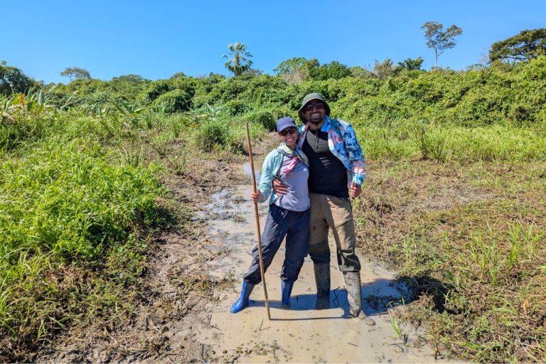
In this post, I’ll share our one-day Pico Austria trek, from our early La Paz departure to reaching the windswept summit. I’ll cover what to pack, what to expect, and why this trek should be on your Bolivia itinerary. We booked through South Treks, which handled our guide, transport, and lunch. A guided tour is a convenient choice for this trek. Grab some coca tea and join me on the journey!
Trek Breakdown
Early Start from La Paz
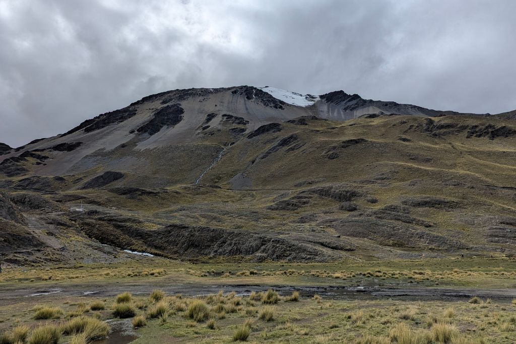
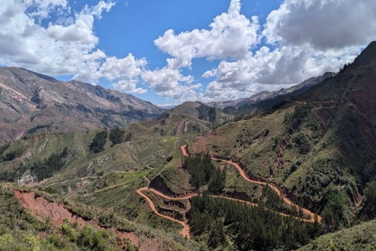
Our day began bright and early at 7:00 am in La Paz, when a South Treks van picked us up from our hostel. We left the city, climbing through El Alto’s busy streets in the morning light. After a quick stop in El Alto to buy last-minute snacks and drinks, we continued onto the high plain. The drive to the trailhead is about 2 to 3 hours long, despite being only ~45 km – blame it on the notorious La Paz traffic and the bumpy dirt roads of the Altiplano.
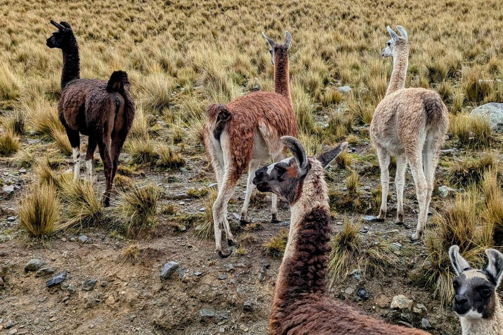
Our excitement built as we passed small Aymara farming villages and herds of alpacas and llamas grazing on scrubby plains. Snowy peaks loomed larger ahead with each mile. By around 10:00 am, we reached La Rinconada (around 4,400 m), the end of the road and starting point of the hike. A local gentleman emerged from a stone hut with a clipboard to collect the National Park fee (20 Bolivianos, about $3) – a small fee for entry into this mountain paradise.
Hitting the Trail – Valleys and Lakes
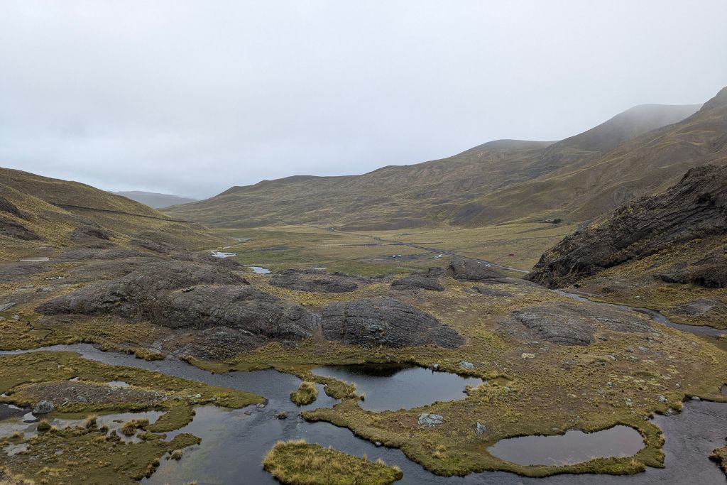
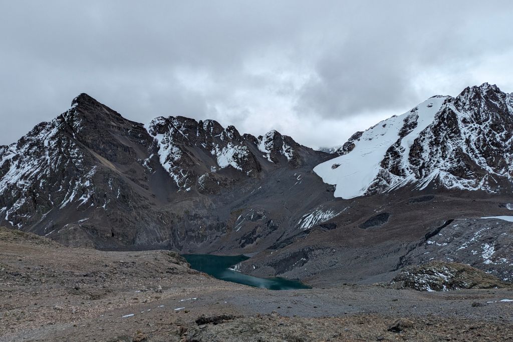
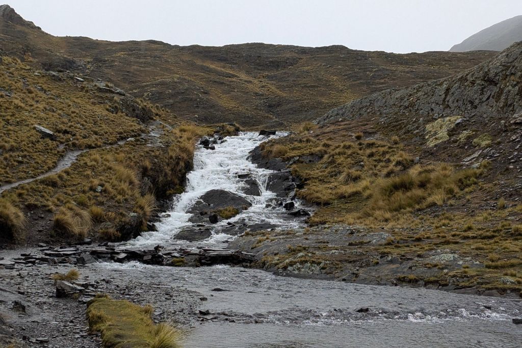
The trail began as a gentle path winding northward through a broad valley. At this lower section, the hiking felt surprisingly easy, a welcome “warm-up” while our lungs adjusted to the high altitude. We followed a stream past golden tussock grass and mossy marshes. Local livestock roamed freely, this area is known for its llama and alpaca pastures. After about 45 minutes of walking, we crested a small rise and arrived at the first major landmark: Laguna Ch’iyar Quta (also called Laguna Chiar Khota), a gleaming alpine lake at ~4,600 m.
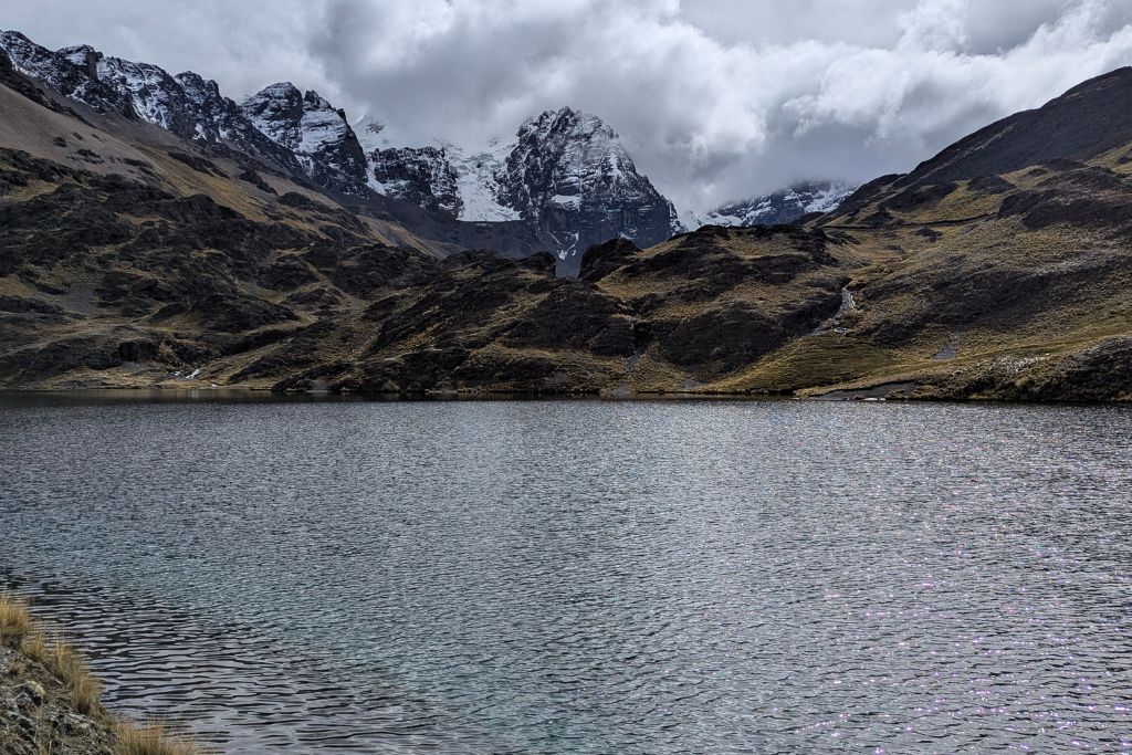
Laguna Ch’iyar Quta (~4,670 m) is a stunning alpine lake along the Pico Austria trail, surrounded by the spires of the Condoriri Massif. This lake, whose name means “black lake” in Aymara, reflects the surrounding peaks like a mirror on calm days. It’s an absolutely beautiful spot and also serves as the base camp for longer Condoriri treks and climbs – a small stone refugio (hut) sits on its shore for those on multi-day adventures.
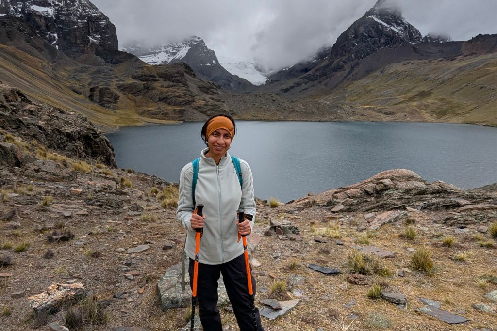
For day hikers like us, Laguna Ch’iyar Quta makes a perfect rest stop. We paused here to catch our breath, take photos, and sip some water. The altitude was definitely noticeable now – even though the trail so far was easy, we were already higher than 4,572 m (15,000 ft). To avoid tiring ourselves too early, we kept the break short.
Important Tip: If you’re doing this trek, listen to your body and pace yourself.
At over 4,600 m, we could feel our hearts thumping a bit faster just from walking slowly on flat ground!) Some groups enjoy an early lunch at this lake, but knowing the hardest part still lay ahead, we decided to just snack on a granola bar and save our boxed lunches for later.
Climbing to Paso Austria (5,000 m)
Skirting the lake’s edge, the trail soon turned upward in earnest. The gentle meandering was over – now it was time to climb. The route toward Paso Austria (Austria Pass) zigzags up a steep slope behind the lake. Almost immediately, we were huffing and puffing. The incline steepened into switchbacks on loose gravel.
With the oxygen level so low at this altitude, our pace slowed to a deliberate plod. I would take 20 steps, then pause to catch my breath, letting my racing heart settle. “Slow and steady” became our mantra, which our guide fully encouraged – there was no rush and pushing too fast could bring on altitude sickness.
As we ascended, the views behind us kept improving (a great excuse to stop and “admire the scenery” whenever I needed a break!). Far below, Laguna Ch’iyar Quta shrank to a tiny jewel, and we could see more blue-green lakes dotting the valley floor. Surrounding us were the giants of the Condoriri Massif – thirteen craggy peaks over 5,000 m encircle this area.
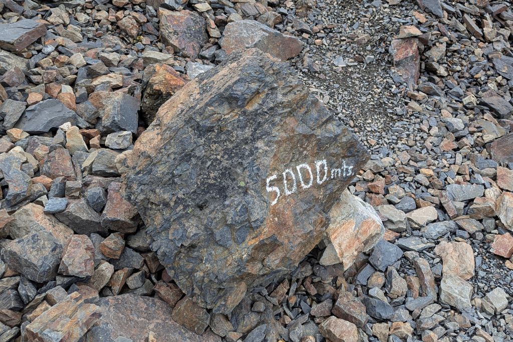
After about an hour of uphill grind, we reached the top of the pass at roughly 5,000 m. This spot, Paso Austria, is a small flat saddle between two ridges, and hitting it felt like a victory. Reaching 5,000 m is no small feat – even though we still had further to go, it’s worth acknowledging! I definitely felt the effects of the thin air here; my head was light and I had slight tingling in my fingers, classic signs that we were way up there.
Important Tip: If you feel an intense headache or nausea at this point, listen to your body. Severe altitude sickness symptoms are a sign to turn around.
We took a longer break at Paso Austria to refuel and bundle up. The wind can really hit you on the exposed ridge. I threw on my down jacket and beanie, since the sun had given way to a chillier overcast sky. From this perch, we could already see some epic vistas – jagged white peaks all around and a glimpse of the Altiplano stretching westward. But the true panorama awaited a bit higher, so after resting ~15 minutes we pressed on for the final push.
Summiting Pico Austria
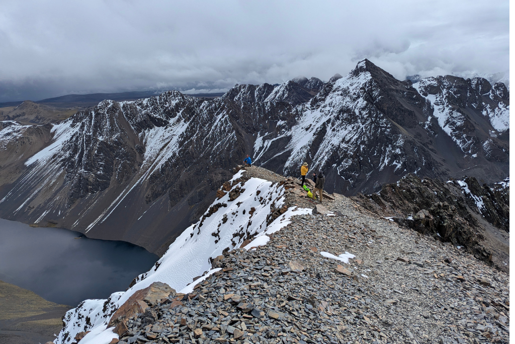
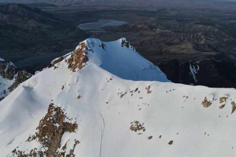
The last leg from the pass to the summit is only about 150 vertical meters (500 ft) of gain, but at this altitude it felt like a marathon. The trail narrowed into a rocky ridge and the terrain grew more rugged – a mix of dirt, scree, and a few patches of hard snow.
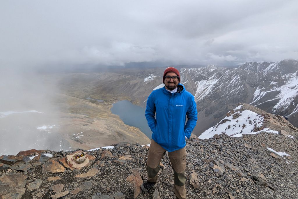
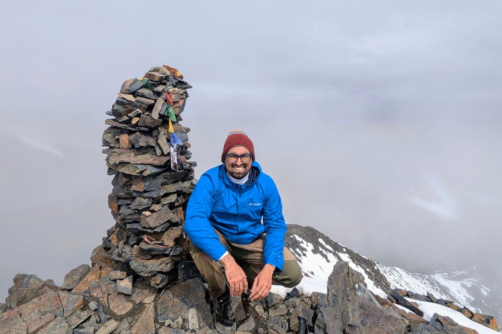
Step by step, we trudged upwards. This is where mental determination matters: it’s easy to get discouraged when every few steps leave you breathing like you just sprinted, but having the summit in sight kept us motivated. Finally, after about 30 more minutes beyond the pass, we conquered the last few meters and stood on the summit of Pico Austria (5,320 m)!
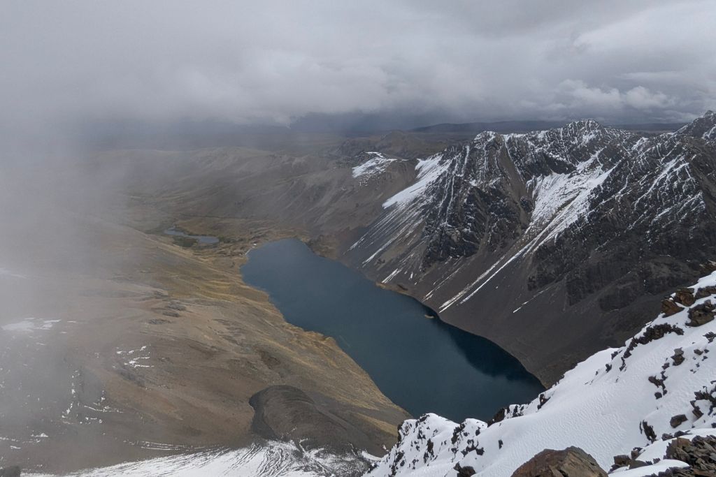
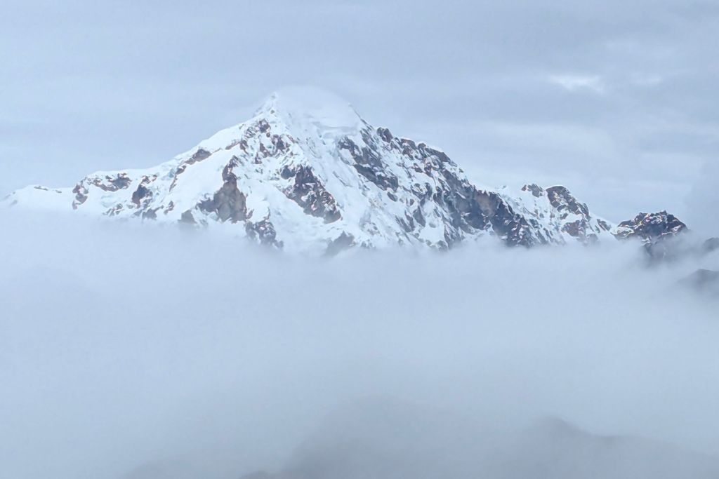
Reaching the summit was both exhilarating and exhausting. In front of us stood the Condoriri group, with Condoriri peak (5,648 m) and its glacier-covered flanks, and Pequeño Alpamayo (5,370 m) nearby. To the south, Huayna Potosí (6,088 m) dominated the skyline, and we could see Lake Titicaca shimmering on the far horizon, nearly 100 km away. The distant city of El Alto was partially visible through haze, and everywhere we looked, there were peaks and sky.
We spent about 20–30 minutes on the summit, soaking in the moment and snapping plenty of photos (got to document that summit victory!). The weather was holding, but clouds were gathering and we knew we had a long hike back, so we couldn’t linger too long. Sure enough, as if on cue, we felt a few flurries of snow – in minutes the sky went from blue patches to a sudden white-out blizzard!
Descent and Return
The descent was significantly faster but still presented challenges. The group carefully retraced the ridge route, with hiking poles proving especially useful on the steep, loose gravel terrain. The upper section posed a risk of slipping, and the earlier ascent had taken a visible toll on everyone’s energy.
As the trail wound downward, the terrain remained demanding but gradually became more manageable. The group maintained a steady pace, pausing occasionally to take in the shifting landscape and changing weather. A brief snow squall passed, clearing to reveal dappled sunshine that lit up the surrounding peaks.
Rather than returning along the exact same path, the guide led a scenic loop past a smaller, emerald-green lake tucked into a side valley – an unexpected highlight. The trail eventually rejoined the original route near Laguna Ch’iyar Quta, which the group reached by late afternoon.
We reached La Rinconada and our waiting van around 5:00 PM, wrapping up roughly 6 hours of hiking, not counting breaks. After peeling off our boots and shaking off the trail dust, we sank into our seats in the van, quiet and spent. No fanfare, just the shared feeling of a tough day done right. We didn’t need much, just a place to sit, catch our breath, and watch the mountains fade in the rearview.
Food & Water on the Trek
Since Pico Austria is a day hike with no huts or shops after leaving La Paz, you need to carry all your food and water. Our tour included a basic lunch: a sandwich, fruit, a chocolate bar, and bottled water. It was just enough to refuel, though nothing special.
Our guide also had coca leaves and candies, which help with altitude symptoms. We also packed extra protein bars and nuts, which came in handy. If you have dietary restrictions, mention it when booking or bring your own fuel. Most importantly bring at least 2–3 L of water per person. There’s nowhere to refill, and the dry mountain air dehydrates fast. I drank about 2 L and could’ve used more.
Gear Checklist: What You’ll Need
Conditions on Pico Austria swing wildly, from sunny to snow in hours. Dress in layers and pack smart. Here’s what I found essential:
- Sturdy hiking boots – Crucial on rocky and loose terrain. Don’t hike this in sneakers.
- Daypack (20–30 L) – Big enough for water, food, and layers.
- Warm layers – I wore a base layer, fleece, and packed a down jacket. A beanie and gloves are a must for the summit wind.
- Rain jacket or hardshell – We had sun, wind, rain, and snow in one day. Be ready for anything.
- Sun protection – High-altitude UV is brutal. Bring SPF 50+, sunglasses, and a sun hat. I burned my neck despite the cold.
- Trekking poles – Optional, but extremely helpful on the descent.
- Snacks & electrolytes – Bring extras. Salty snacks and drink mixes can h
- elp prevent altitude headaches.
One last tip: Pack everything inside plastic bags or dry sacks. Unexpected snow or stream crossings can soak your gear. We started in T-shirts and ended in jackets – this hike is all about layering for the extremes.
Complete Packing List: Check out our essential hiking gear list HERE!!
Why Hike Pico Austria?
With so many treks in the Andes, you might wonder why Pico Austria? For me, it hit the sweet spot: high-altitude challenge, epic scenery, and zero technical skills required, all in a single day.
A Perfect Acclimatization Hike
If you’re planning to climb bigger peaks like Huayna Potosí or Illimani, Pico Austria is a smart warm-up. Hiking above 5,000 m gives your body a chance to adjust in a controlled setting. We met a few trekkers using this hike to test how they handled the altitude and it’s way better to learn your limits here than mid-expedition on a tougher climb.
Big Mountain Feel, No Gear Needed
You don’t need ropes, crampons, or climbing experience. It’s just a steep, sustained hike that rewards you with summit vibes and panoramic views at 5,300 m. It’s demanding but very doable for fit hikers. The altitude is the main challenge, not the trail itself.
Stunning Views
The scenery is what really sets this hike apart. You’ll pass alpine lakes, wind through glacial valleys, and, if you’re lucky, spot condors circling above the Cordillera Real. From the summit, the view of snow-capped peaks like Huayna Potosí is unreal. The trail isn’t crowded either at times, it felt like we had the whole range to ourselves.
Day Trip from La Paz
This trek fits into a single day. We left early, hiked, and were back in La Paz by dinner. That alone makes it one of the most accessible high-altitude experiences in Bolivia. Public transport doesn’t reach the trailhead, so going with a tour made logistics easy, and gave us the added safety net in case anything went wrong at altitude.
If you’ve got some hiking experience and want to challenge yourself at elevation, I’d say go for it. You don’t need to be a mountaineer, just be prepared and willing to push a bit. It’s the kind of hike that builds confidence for bigger mountains. For us, it was the hike that prepared us for Huayna Potosi.
This post includes affiliate links, which means that if you make a purchase or booking through them, we may receive a small commission. It doesn’t cost you anything extra, but it helps us keep the blog going. We truly appreciate your support!
Read More About Bolivia
READY TO TRAVEL LIKE A LOCAL?
Book a free 30-minute consulting call with us and let’s start planning your next unforgettable adventure!